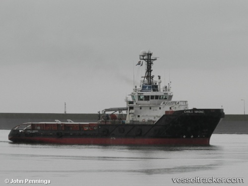
 VB CARLO MAGNO
Current Status
Where is the vessel?
VB CARLO MAGNO is currently in 26 nm NW of Leba, based on AIS data received about 15h ago.
Latest AIS update:
Current position: 55.11823° N, 17.17983° E (26 nm NW of Leba)
Average speed (last 7 days): Loading…
Average speed (last 30 days): Loading…
Vessel profile: VB CARLO MAGNO is a Anchor Handling Vessel with dimensions m x m.
This page combines live AIS, route history, probable destination signals, nearby traffic, and port activity for practical vessel monitoring.
The current position of vessel VB CARLO MAGNO is 55.11823 lat / 17.17983 lng. Updated: 2026-05-23 05:19:08 UTCNearest reference points:
- 31 nm NW of Ustka
- Near WLADYSLAWOWO
- Near Gdynia
Currently sailing under the flag of Malta ![]()
Details:
Live Vessel VB CARLO MAGNO Analytics (details, animations, etc.)
Recent AIS points (UTC):
2026-05-23 01:49:44 UTC · 55.08559, 17.18388 · SOG 0.6 kn · COG -1°2026-05-23 04:04:28 UTC · 55.11829, 17.17981 · SOG 0 kn · COG -1°
2026-05-23 04:19:51 UTC · 55.11826, 17.17986 · SOG 0 kn · COG -1°
2026-05-23 05:19:08 UTC · 55.11823, 17.17983 · SOG 0 kn · COG -1°