 ALQADISIA
Current Status
Where is the vessel?
ALQADISIA is currently in 27 nm N of Sebang, based on AIS data received about 15h ago.
Latest AIS update:
Current position: 6.35133° N, 95.22640° E (27 nm N of Sebang)
Average speed (last 7 days): Loading…
Average speed (last 30 days): Loading…
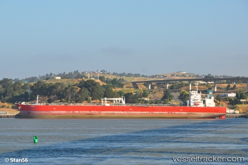
Vessel profile: ALQADISIA is a Crude Oil Tanker with dimensions m x m.
This page combines live AIS, route history, probable destination signals, nearby traffic, and port activity for practical vessel monitoring.
The current position of vessel ALQADISIA is 6.35133 lat / 95.22640 lng. Updated: 2026-05-18 23:24:05 UTCNearest reference points:
- 28 nm NW of Sebang
- 21 nm N of Sebang
- 53 nm NE of Sebang
Currently sailing under the flag of Marshall Islands ![]()
Details:
Live Vessel ALQADISIA Analytics (details, animations, etc.)
Recent AIS points (UTC):
2026-05-18 19:49:04 UTC · 6.27022, 95.87397 · SOG 11.4 kn · COG 272°2026-05-18 22:14:04 UTC · 6.32715, 95.44080 · SOG 11.3 kn · COG 267°
2026-05-18 22:18:45 UTC · 6.32898, 95.42612 · SOG 11.4 kn · COG 267°
2026-05-18 23:24:05 UTC · 6.35133, 95.22640 · SOG 11 kn · COG 271°