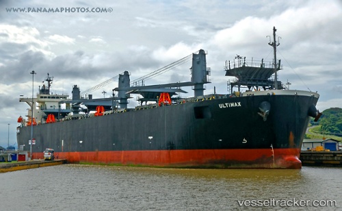
 ULTIMAX
Current Status
Where is the vessel?
ULTIMAX is currently in 205 nm NW of Tijarafe, based on AIS data received about 15h ago.
Latest AIS update:
Current position: 30.01453° N, 21.55684° W (205 nm NW of Tijarafe)
Average speed (last 7 days): Loading…
Average speed (last 30 days): Loading…
Vessel profile: ULTIMAX is a Wood Chips Carrier with dimensions 210m x 210m.
This page combines live AIS, route history, probable destination signals, nearby traffic, and port activity for practical vessel monitoring.
The current position of vessel ULTIMAX is 30.01453 lat / -21.55684 lng. Updated: 2026-05-19 17:42:00 UTCNearest reference points:
- 100 nm W of Tijarafe
- 119 nm W of Frontera
- 137 nm SW of Ponta do Pargo
Currently sailing under the flag of Liberia ![]()
ULTIMAX built in 2006 year
Deadweight:
54347 tDetails:
Live Vessel ULTIMAX Analytics (details, animations, etc.)
Recent AIS points (UTC):
2026-05-19 13:16:31 UTC · 29.55895, -22.10346 · SOG 8.6 kn · COG 47°2026-05-19 16:02:02 UTC · 29.83771, -21.76178 · SOG 8.8 kn · COG 45°
2026-05-19 16:07:20 UTC · 29.84681, -21.75096 · SOG 8.7 kn · COG 45°
2026-05-19 17:42:00 UTC · 30.01453, -21.55684 · SOG 9.2 kn · COG 46°