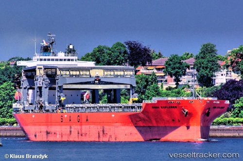
 SAGA EXPLORER
Current Status
Where is the vessel?
SAGA EXPLORER is currently in 36 nm W of Jorf Lasfar, based on AIS data received about 14h ago.
Latest AIS update:
Current position: 33.24161° N, 9.31304° W (36 nm W of Jorf Lasfar)
Average speed (last 7 days): Loading…
Average speed (last 30 days): Loading…
Vessel profile: SAGA EXPLORER is a General Cargo with dimensions m x m.
This page combines live AIS, route history, probable destination signals, nearby traffic, and port activity for practical vessel monitoring.
The current position of vessel SAGA EXPLORER is 33.24161 lat / -9.31304 lng. Updated: 2026-05-22 05:51:07 UTCNearest reference points:
- 52 nm NW of Safi
- 51 nm NW of Jorf Lasfar
- 21 nm NW of El Jadida
Currently sailing under the flag of Bahamas ![]()
Details:
Live Vessel SAGA EXPLORER Analytics (details, animations, etc.)
Recent AIS points (UTC):
2026-05-22 02:34:59 UTC · 32.79170, -9.80789 · SOG 11.1 kn · COG 36°2026-05-22 04:00:50 UTC · 32.99474, -9.59943 · SOG 11.2 kn · COG 44°
2026-05-22 04:22:35 UTC · 33.04301, -9.54345 · SOG 11.2 kn · COG 44°
2026-05-22 05:51:07 UTC · 33.24161, -9.31304 · SOG 11.3 kn · COG 42°