 PERGAMOS
Current Status
Where is the vessel?
PERGAMOS is currently in 237 nm S of Ile Desroches, based on AIS data received about 14h ago.
Latest AIS update:
Current position: 9.62730° S, 53.96207° E (237 nm S of Ile Desroches)
Average speed (last 7 days): Loading…
Average speed (last 30 days): Loading…
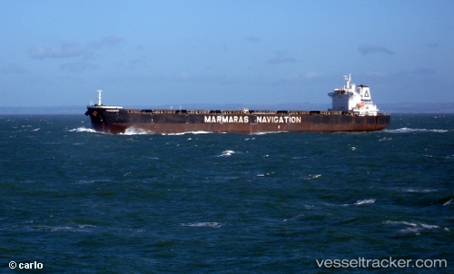
Vessel profile: PERGAMOS is a Bulk Carrier with dimensions 230m x 37m.
This page combines live AIS, route history, probable destination signals, nearby traffic, and port activity for practical vessel monitoring.
The current position of vessel PERGAMOS is -9.62730 lat / 53.96207 lng. Updated: 2026-05-22 01:48:58 UTCNearest reference points:
- 217 nm SE of Ile Desroches
- 130 nm S of Ile Desroches
- Open sea, approx. 408 nm off the nearest listed port
Currently sailing under the flag of Liberia ![]()
PERGAMOS built in 2007 year
Deadweight:
92832 tDetails:
Live Vessel PERGAMOS Analytics (details, animations, etc.)
Recent AIS points (UTC):
2026-05-21 19:59:47 UTC · -9.98830, 53.04447 · SOG 9.9 kn · COG 68°2026-05-21 21:38:05 UTC · -9.89972, 53.30493 · SOG 9.8 kn · COG 68°
2026-05-21 22:16:58 UTC · -9.86310, 53.40893 · SOG 10.5 kn · COG 64°
2026-05-22 01:48:58 UTC · -9.62730, 53.96207 · SOG 10.1 kn · COG 69°