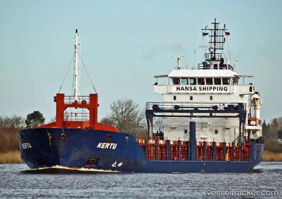
 Kertu
Kertu
Current Status
Where is the vessel?
Kertu is currently in 16 nm SE of Ystad, based on AIS data received about 15h ago.
Latest AIS update:
Current position: 55.16799° N, 14.00407° E (16 nm SE of Ystad)
Average speed (last 7 days): Loading…
Average speed (last 30 days): Loading…
Vessel profile: Kertu is a Multi Purpose Carrier with dimensions 101m x 15m.
This page combines live AIS, route history, probable destination signals, nearby traffic, and port activity for practical vessel monitoring.
The current position of vessel Kertu is 55.16799 lat / 14.00407 lng. Updated: 2026-05-20 06:06:07 UTCNearest reference points:
- Near SASSNITZ
- Near Breege
- Near Glowe
Currently sailing under the flag of Malta ![]()
Kertu built in 2005 year
Deadweight:
4800 tDetails:
Live Vessel Kertu Analytics (details, animations, etc.)
Recent AIS points (UTC):
2026-05-20 02:07:47 UTC · 55.24430, 12.86205 · SOG 10 kn · COG 110°2026-05-20 04:09:08 UTC · 55.19392, 13.44577 · SOG 10 kn · COG 95°
2026-05-20 04:43:17 UTC · 55.18614, 13.61096 · SOG 10 kn · COG 94°
2026-05-20 06:06:07 UTC · 55.16799, 14.00407 · SOG 9.7 kn · COG 94°