 MAYFLOWER II
Current Status
Where is the vessel?
MAYFLOWER II is currently in Near Kralendijk, based on AIS data received about 15h ago.
Latest AIS update:
Current position: 12.14746° N, 68.27757° W (Near Kralendijk)
Average speed (last 7 days): Loading…
Average speed (last 30 days): Loading…
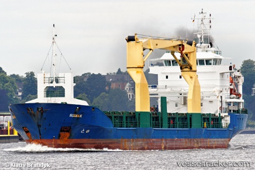
Vessel profile: MAYFLOWER II is a General Cargo with dimensions m x m.
This page combines live AIS, route history, probable destination signals, nearby traffic, and port activity for practical vessel monitoring.
The current position of vessel MAYFLOWER II is 12.14746 lat / -68.27757 lng. Updated: 2026-05-20 23:28:59 UTCNearest reference points:
- Near Bullenbaai
- Near Las Piedras
- 24 nm NW of Palm Beach
Currently sailing under the flag of Panama ![]()
Details:
Live Vessel MAYFLOWER II Analytics (details, animations, etc.)
Recent AIS points (UTC):
2026-05-20 19:34:59 UTC · 12.14750, -68.27759 · SOG 0 kn · COG 167°2026-05-20 22:11:02 UTC · 12.14747, -68.27759 · SOG 0 kn · COG 167°
2026-05-20 23:05:02 UTC · 12.14748, -68.27758 · SOG 0 kn · COG 167°
2026-05-20 23:28:59 UTC · 12.14746, -68.27757 · SOG 0.1 kn · COG 167°