 NORTHUMBERLAND
Current Status
Where is the vessel?
NORTHUMBERLAND is currently in Near Wood Island, based on AIS data received about 14h ago.
Latest AIS update:
Current position: 45.95351° N, 62.74970° W (Near Wood Island)
Average speed (last 7 days): Loading…
Average speed (last 30 days): Loading…
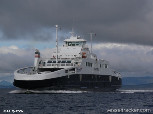
Vessel profile: NORTHUMBERLAND is a Ro-Ro/Passenger Ship with dimensions m x m.
This page combines live AIS, route history, probable destination signals, nearby traffic, and port activity for practical vessel monitoring.
The current position of vessel NORTHUMBERLAND is 45.95351 lat / -62.74970 lng. Updated: 2026-05-20 01:19:07 UTCNearest reference points:
- Near Goldboro
- 20 nm S of Head of Jeddore
- Near Halifax
Currently sailing under the flag of Canada ![]()
Details:
Live Vessel NORTHUMBERLAND Analytics (details, animations, etc.)
Recent AIS points (UTC):
2026-05-19 22:37:18 UTC · 45.73954, -62.68875 · SOG 0 kn · COG 21°2026-05-19 23:26:05 UTC · 45.88402, -62.72148 · SOG 15.3 kn · COG 341°
2026-05-20 01:19:07 UTC · 45.95351, -62.74970 · SOG 0 kn · COG 213°
2026-05-20 01:19:07 UTC · 45.95351, -62.74970 · SOG 0 kn · COG 213°