 MONJASA LEADER
Current Status
Where is the vessel?
MONJASA LEADER is currently in Near Lome, based on AIS data received about 14h ago.
Latest AIS update:
Current position: 5.99510° N, 1.24917° E (Near Lome)
Average speed (last 7 days): Loading…
Average speed (last 30 days): Loading…
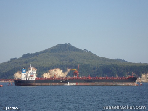
Vessel profile: MONJASA LEADER is a Oil Products Tanker with dimensions m x m.
This page combines live AIS, route history, probable destination signals, nearby traffic, and port activity for practical vessel monitoring.
The current position of vessel MONJASA LEADER is 5.99510 lat / 1.24917 lng. Updated: 2026-05-19 19:33:07 UTCNearest reference points:
- Near Ablogamé
- Near Cotonou
- Near Kirikiri
Currently sailing under the flag of Liberia ![]()
Details:
Live Vessel MONJASA LEADER Analytics (details, animations, etc.)
Recent AIS points (UTC):
2026-05-19 16:18:32 UTC · 5.99500, 1.24667 · SOG 0 kn · COG -1°2026-05-19 17:27:31 UTC · 5.99500, 1.24667 · SOG 0 kn · COG -1°
2026-05-19 19:30:11 UTC · 5.99512, 1.24914 · SOG 0.2 kn · COG 220°
2026-05-19 19:33:07 UTC · 5.99510, 1.24917 · SOG 0.5 kn · COG 219°