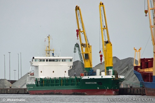
 Bremer Elena
Current Status
Where is the vessel?
Bremer Elena is currently in Near Puerto Sucre, based on AIS data received about 15h ago.
Latest AIS update:
Current position: 10.43760° N, 64.22470° W (Near Puerto Sucre)
Average speed (last 7 days): Loading…
Average speed (last 30 days): Loading…
Vessel profile: Bremer Elena is a Multi Purpose Carrier with dimensions 90m x 16m.
This page combines live AIS, route history, probable destination signals, nearby traffic, and port activity for practical vessel monitoring.
The current position of vessel Bremer Elena is 10.4376 lat / -64.2247 lng. Updated: 2026-05-21 03:36:32 UTCNearest reference points:
- Near Puerto Sucre
- 15 nm SW of Punta de Piedras
- Near ST GEORGES
Currently sailing under the flag of Germany ![]()
Bremer Elena built in 2007 year
Deadweight:
4316 tDetails:
Live Vessel Bremer Elena Analytics (details, animations, etc.)
Recent AIS points (UTC):
2026-05-20 23:52:55 UTC · 10.43740, -64.22460 · SOG 0 kn · COG 50°2026-05-20 23:52:55 UTC · 10.43740, -64.22460 · SOG 0 kn · COG 50°
2026-05-21 03:36:32 UTC · 10.43760, -64.22470 · SOG 0 kn · COG 61°
2026-05-21 03:36:32 UTC · 10.43760, -64.22470 · SOG 0 kn · COG 61°