.

LR flag Andros Navigator

Vessel type: Bulk Carrier | IMO: 9350800 | MMSI: MMSI: 636018938
Call sign: D5SC8 | Dimensions: 290 m x 48 m
Current Status

Where is the vessel?

Andros Navigator is currently in 37 nm SW of Xijiang, based on AIS data received about 14h ago.

Latest AIS update:

Current position: 20.85797° N, 114.38740° E (37 nm SW of Xijiang)

Average speed (last 7 days): Loading…

Average speed (last 30 days): Loading…

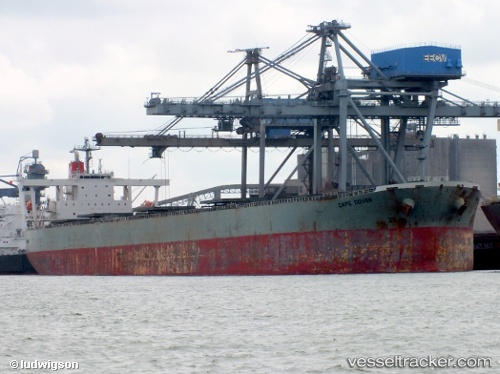
Vessel profile: Andros Navigator is a Bulk Carrier with dimensions 290m x 48m.

This page combines live AIS, route history, probable destination signals, nearby traffic, and port activity for practical vessel monitoring.

The current position of vessel Andros Navigator is 20.85797 lat / 114.38740 lng. Updated: 2026-05-20 09:39:06 UTC
More recent position available: 1 h 32 min ago
Free positions are delayed by 14 hours.

We recommend registering. If you register, paid vessel access will be saved in your profile. Guest access works only through a personal link.

Nearest reference points:
  • 42 nm SE of Wanshan Pt
  • 44 nm S of Wanshan Pt
  • 33 nm SE of Wanshan Pt

Currently sailing under the flag of Liberia LR flag

Andros Navigator built in 2006 year

Deadweight:
185805 t

Details:

Live Vessel Andros Navigator Analytics (details, animations, etc.)


Recent AIS points (UTC):
2026-05-20 05:31:38 UTC · 20.44515, 115.02592 · SOG 10.5 kn · COG 299°
2026-05-20 07:26:34 UTC · 20.59673, 114.70578 · SOG 11.2 kn · COG 297°
2026-05-20 07:49:42 UTC · 20.62737, 114.63962 · SOG 11 kn · COG 294°
2026-05-20 09:39:06 UTC · 20.85797, 114.38740 · SOG 10.4 kn · COG 320°

UTC: --
Start: -- Track timeline (UTC) End: --
Encountered: --


Link to the map:


Find another ship

Andros_Navigator (636018938) last ports (portcalls and passsages)

Wedgefield | 2025-09-08 11:06:47
Qingdao | 2025-08-20 00:09:27
PENGERANG | 2025-08-08 16:15:39
TANAH MERAH | 2025-08-06 05:18:51
PULAU SAMBU | 2025-08-06 02:54:15
TALIARTE | 2025-05-06 21:10:59
Puerto De La Luz | 2025-05-06 19:25:14
TALIARTE | 2025-05-02 10:37:47
Puerto De La Luz | 2025-05-02 09:50:03
Richards Bay | 2024-09-02 02:51:25
Richards Bay | 2024-08-29 02:48:57
Fangcheng | 2024-07-11 15:01:59
Port Headland | 2024-06-27 16:52:21
Port Hedland | 2024-06-27 15:36:43
Selat Lombok | 2024-06-22 01:02:47
Fangcheng | 2024-06-10 13:13:14
Sambu | 2024-06-04 06:21:15
Saldanha Bay | 2024-05-11 18:22:16
Saldanha Bay | 2024-05-02 18:26:21
Singapore | 2024-04-02 03:39:45
Jingjiang | 2024-02-24 02:12:01
Selat Lombok | 2024-02-07 07:19:07
Esperance | 2024-01-28 08:25:34
Esperance | 2024-01-24 08:07:58
Qingdao | 2024-01-05 02:59:16
Sambu | 2023-12-19 04:33:02
Singapore | 2023-09-22 09:35:25
Zhangjiagang | 2023-08-31 23:43:28
Taicang | 2023-08-31 19:01:54
Wusong | 2023-08-31 16:22:03
Jingjiang | 2023-08-31 11:29:45
Dagu Bar | 2023-08-28 17:07:14
Taku Bar | 2023-08-27 04:57:53
Sambu | 2023-08-13 17:41:51
Sambu | 2023-05-09 09:02:46
Qingdao | 2023-04-01 10:14:46
Vishakhapatnam | 2022-12-12 05:25:28
Singapore | 2022-12-06 02:24:46
Wusong | 2022-10-20 01:51:49
Lianyungang | 2022-10-14 07:54:23
Port Elizabeth | 2022-09-08 07:03:43
Vishakhapatnam | 2022-07-08 22:56:32
Vishakhapatnam | 2022-07-04 22:36:51
Okha | 2022-05-02 12:02:13
Okha | 2022-04-20 03:05:11
Mina Saqr | 2022-04-12 18:20:00
Ra’S Shukhayr | 2022-03-20 03:16:35
Port Said | 2022-03-19 06:25:28
Algeciras | 2022-03-10 18:10:09
Strait Of Gibraltar | 2022-03-10 03:10:04
Annapolis | 2022-02-24 21:55:52
Baltimore | 2022-02-23 00:05:54
Annapolis | 2022-02-21 00:16:50
Ra’S Shukhayr | 2022-01-30 02:04:42
Sambu | 2022-01-14 05:20:40
Singapore | 2022-01-14 04:50:40
Singapore | 2022-01-14 04:45:40
Sambu | 2022-01-14 04:45:06
Wusong | 2022-01-03 05:37:33
Sambu | 2021-12-11 05:40:25