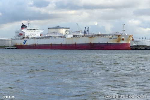
Sand Shiner
Current StatusWhere is the vessel?
Sand Shiner is currently in 53 nm NW of Camarones, based on AIS data received about 14h ago.
Latest AIS update:
Current position: 12.08379° N, 73.63397° W (53 nm NW of Camarones)
Average speed (last 7 days): Loading…
Average speed (last 30 days): Loading…
Vessel profile: Sand Shiner is a Crude Oil Tanker with dimensions 33m x 219m.
This page combines live AIS, route history, probable destination signals, nearby traffic, and port activity for practical vessel monitoring.
The current position of vessel Sand Shiner is 12.08379 lat / -73.63397 lng. Updated: 2026-05-21 19:31:01 UTCNearest reference points:
- 18 nm N of Santa Marta
- Near Santa Marta
- Near PUERTO BOLIVAR
Details:
Live Vessel Sand Shiner Analytics (details, animations, etc.)
Recent AIS points (UTC):
2026-05-21 15:58:09 UTC · 12.31037, -73.01918 · SOG 11.1 kn · COG 249°2026-05-21 18:08:17 UTC · 12.17300, -73.39505 · SOG 10.8 kn · COG -1°
2026-05-21 19:08:27 UTC · 12.10938, -73.57045 · SOG 10.8 kn · COG -1°
2026-05-21 19:31:01 UTC · 12.08379, -73.63397 · SOG 10.5 kn · COG 245°