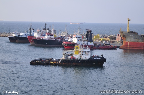
Britoil 64
Current StatusWhere is the vessel?
Britoil 64 is currently in 34 nm E of Bandar Al Mishab, based on AIS data received about 14h ago.
Latest AIS update:
Current position: 28.16901° N, 49.35881° E (34 nm E of Bandar Al Mishab)
Average speed (last 7 days): Loading…
Average speed (last 30 days): Loading…
Vessel profile: Britoil 64 is a Tug with dimensions 11m x 40m.
This page combines live AIS, route history, probable destination signals, nearby traffic, and port activity for practical vessel monitoring.
The current position of vessel Britoil 64 is 28.16901 lat / 49.35881 lng. Updated: 2026-05-22 01:43:42 UTCNearest reference points:
- 29 nm E of Bandar Al Mishab
- 26 nm E of Bandar Al Mishab
- 41 nm NE of Ras Al Khair
Details:
Live Vessel Britoil 64 Analytics (details, animations, etc.)
Recent AIS points (UTC):
2026-05-21 20:11:10 UTC · 28.23167, 49.23833 · SOG 3 kn · COG -1°2026-05-21 21:59:55 UTC · 28.23832, 49.25537 · SOG 2.8 kn · COG 233°
2026-05-21 22:19:51 UTC · 28.23485, 49.24947 · SOG 0.6 kn · COG 215°
2026-05-22 01:43:42 UTC · 28.16901, 49.35881 · SOG 2.7 kn · COG 92°