 ATLANTIS A
Current Status
Where is the vessel?
ATLANTIS A is currently in 20 nm S of Ferring, based on AIS data received about 14h ago.
Latest AIS update:
Current position: 50.47901° N, 0.27558° W (20 nm S of Ferring)
Average speed (last 7 days): Loading…
Average speed (last 30 days): Loading…
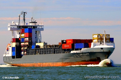
Vessel profile: ATLANTIS A is a Container Ship with dimensions 134m x 134m.
This page combines live AIS, route history, probable destination signals, nearby traffic, and port activity for practical vessel monitoring.
The current position of vessel ATLANTIS A is 50.47901 lat / -0.27558 lng. Updated: 2026-05-18 21:27:37 UTCNearest reference points:
- 23 nm S of Ferring
- 27 nm S of Seaford
- 15 nm S of Selsey
Currently sailing under the flag of Portugal (MAR) ![]()
ATLANTIS A built in 2007 year
Deadweight:
11435 tDetails:
Live Vessel ATLANTIS A Analytics (details, animations, etc.)
Recent AIS points (UTC):
2026-05-18 17:33:37 UTC · 50.70893, 0.78084 · SOG 12.5 kn · COG 232°2026-05-18 19:14:18 UTC · 50.56162, 0.29834 · SOG 11.6 kn · COG 256°
2026-05-18 20:01:26 UTC · 50.52611, 0.07827 · SOG 10.4 kn · COG 256°
2026-05-18 21:27:37 UTC · 50.47901, -0.27558 · SOG 9 kn · COG 259°