 Energy Navigator
Current Status
Where is the vessel?
Energy Navigator is currently in 78 nm NW of Camar Marine Terminal, based on AIS data received about 14h ago.
Latest AIS update:
Current position: 5.20333° S, 112.30667° E (78 nm NW of Camar Marine Terminal)
Average speed (last 7 days): Loading…
Average speed (last 30 days): Loading…
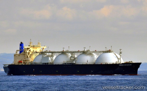
Vessel profile: Energy Navigator is a Lng Tanker with dimensions 289m x 49m.
This page combines live AIS, route history, probable destination signals, nearby traffic, and port activity for practical vessel monitoring.
The current position of vessel Energy Navigator is -5.20333 lat / 112.30667 lng. Updated: 2026-05-18 19:49:20 UTCNearest reference points:
- 60 nm NW of Camar Marine Terminal
- 50 nm N of Camar Marine Terminal
- 68 nm NW of Gagak Rimang Fso
Currently sailing under the flag of Japan ![]()
Details:
Live Vessel Energy Navigator Analytics (details, animations, etc.)
Recent AIS points (UTC):
2026-05-18 16:19:17 UTC · -4.93333, 111.77667 · SOG 10 kn · COG -1°2026-05-18 18:07:21 UTC · -5.08500, 112.04833 · SOG 10 kn · COG -1°
2026-05-18 19:43:20 UTC · -5.19667, 112.29333 · SOG 9 kn · COG -1°
2026-05-18 19:49:20 UTC · -5.20333, 112.30667 · SOG 9 kn · COG -1°