 vesseltracker.com
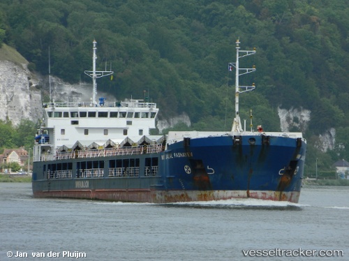
 ROYAD MAMMADOV
Current Status
Where is the vessel?
ROYAD MAMMADOV is currently in 21 nm SE of Hydra (Idhra), based on AIS data received about 15h ago.
Latest AIS update:
Current position: 37.07195° N, 23.74104° E (21 nm SE of Hydra (Idhra))
Average speed (last 7 days): Loading…
Average speed (last 30 days): Loading…
Vessel profile: ROYAD MAMMADOV is a General Cargo with dimensions m x m.
This page combines live AIS, route history, probable destination signals, nearby traffic, and port activity for practical vessel monitoring.
The current position of vessel ROYAD MAMMADOV is 37.07195 lat / 23.74104 lng. Updated: 2026-05-18 07:52:09 UTCNearest reference points:
- 20 nm E of FOKIANOS
- Near Methana
- 17 nm W of Milos (Adamas)
Currently sailing under the flag of Saint Kitts and Nevis ![]()
Details:
Live Vessel ROYAD MAMMADOV Analytics (details, animations, etc.)
Recent AIS points (UTC):
2026-05-18 04:11:50 UTC · 37.45631, 24.03040 · SOG 7.3 kn · COG 208°2026-05-18 05:55:39 UTC · 37.27519, 23.89830 · SOG 7.6 kn · COG 209°
2026-05-18 07:16:39 UTC · 37.13293, 23.78779 · SOG 7.3 kn · COG 210°
2026-05-18 07:52:09 UTC · 37.07195, 23.74104 · SOG 7.2 kn · COG 209°