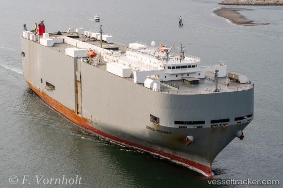
London Highway
Current StatusWhere is the vessel?
London Highway is currently in 53 nm E of Fenwick Island, based on AIS data received about 15h ago.
Latest AIS update:
Current position: 38.30435° N, 73.94120° W (53 nm E of Fenwick Island)
Average speed (last 7 days): Loading…
Average speed (last 30 days): Loading…
Vessel profile: London Highway is a Vehicles Carrier with dimensions 32m x 199m.
This page combines live AIS, route history, probable destination signals, nearby traffic, and port activity for practical vessel monitoring.
The current position of vessel London Highway is 38.30435 lat / -73.94120 lng. Updated: 2026-05-21 11:59:57 UTCNearest reference points:
- 57 nm E of Fenwick Island
- 24 nm E of West Ocean City
- Near Corbin City
Details:
Live Vessel London Highway Analytics (details, animations, etc.)
Recent AIS points (UTC):
2026-05-21 08:00:29 UTC · 37.19997, -74.25263 · SOG 17.1 kn · COG 14°2026-05-21 09:34:33 UTC · 37.63761, -74.12607 · SOG 17.1 kn · COG 8°
2026-05-21 10:30:39 UTC · 37.89861, -74.07381 · SOG 16.9 kn · COG 7°
2026-05-21 11:59:57 UTC · 38.30435, -73.94120 · SOG 17 kn · COG 18°