Tour 2
Current StatusWhere is the vessel?
Tour 2 is currently in 41 nm SE of Pinghai, based on AIS data received about 14h ago.
Latest AIS update:
Current position: 21.97303° N, 115.16212° E (41 nm SE of Pinghai)
Average speed (last 7 days): Loading…
Average speed (last 30 days): Loading…
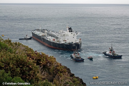
Vessel profile: Tour 2 is a Crude Oil Tanker with dimensions 48m x 274m.
This page combines live AIS, route history, probable destination signals, nearby traffic, and port activity for practical vessel monitoring.
The current position of vessel Tour 2 is 21.97303 lat / 115.16212 lng. Updated: 2026-05-22 08:21:25 UTCNearest reference points:
- 49 nm S of SHANWEI
- 14 nm S of Pinghai
- 25 nm SE of Wan Tsai
Details:
Live Vessel Tour 2 Analytics (details, animations, etc.)
Recent AIS points (UTC):
2026-05-22 03:53:29 UTC · 21.97361, 115.16127 · SOG 0.1 kn · COG 259°2026-05-22 05:07:20 UTC · 21.97364, 115.16115 · SOG 0.1 kn · COG -1°
2026-05-22 06:59:27 UTC · 21.97321, 115.16249 · SOG 0 kn · COG 268°
2026-05-22 08:21:25 UTC · 21.97303, 115.16212 · SOG 0.3 kn · COG -1°