 FULMAR S
Current Status
Where is the vessel?
FULMAR S is currently in Near NEMRUT, based on AIS data received about 14h ago.
Latest AIS update:
Current position: 38.76633° N, 26.91202° E (Near NEMRUT)
Average speed (last 7 days): Loading…
Average speed (last 30 days): Loading…
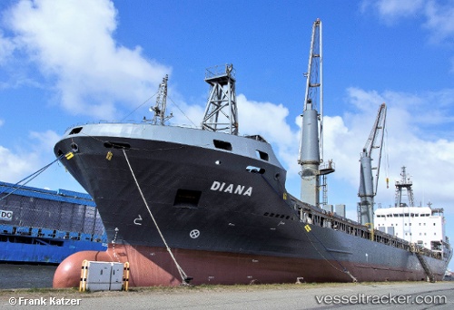
Vessel profile: FULMAR S is a General Cargo with dimensions m x m.
This page combines live AIS, route history, probable destination signals, nearby traffic, and port activity for practical vessel monitoring.
The current position of vessel FULMAR S is 38.76633 lat / 26.91202 lng. Updated: 2026-05-22 07:56:50 UTCNearest reference points:
- Near NEMRUT
- Near Nemrut Bay
- Near Aliaga
Currently sailing under the flag of Turkey ![]()
Details:
Live Vessel FULMAR S Analytics (details, animations, etc.)
Recent AIS points (UTC):
2026-05-22 04:14:50 UTC · 38.76632, 26.91199 · SOG 0 kn · COG 155°2026-05-22 06:20:49 UTC · 38.76633, 26.91201 · SOG 0 kn · COG 155°
2026-05-22 07:21:49 UTC · 38.76631, 26.91201 · SOG 0 kn · COG -1°
2026-05-22 07:56:50 UTC · 38.76633, 26.91202 · SOG 0 kn · COG 155°