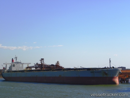
Cape Alliance
Current StatusWhere is the vessel?
Cape Alliance is currently in Near HUANGHUA, based on AIS data received about 14h ago.
Latest AIS update:
Current position: 38.36798° N, 117.90946° E (Near HUANGHUA)
Average speed (last 7 days): Loading…
Average speed (last 30 days): Loading…
Vessel profile: Cape Alliance is a Ore Carrier with dimensions 50m x 300m.
This page combines live AIS, route history, probable destination signals, nearby traffic, and port activity for practical vessel monitoring.
The current position of vessel Cape Alliance is 38.36798 lat / 117.90946 lng. Updated: 2026-05-22 10:27:13 UTCNearest reference points:
- 11 nm NW of HUANGHUA
- Near HUANGHUA
- 16 nm NW of HUANGHUA
Details:
Live Vessel Cape Alliance Analytics (details, animations, etc.)
Recent AIS points (UTC):
2026-05-22 07:36:13 UTC · 38.36796, 117.90950 · SOG 0 kn · COG 240°2026-05-22 08:30:13 UTC · 38.36799, 117.90947 · SOG 0 kn · COG 240°
2026-05-22 10:15:13 UTC · 38.36798, 117.90950 · SOG 0 kn · COG 240°
2026-05-22 10:27:13 UTC · 38.36798, 117.90946 · SOG 0 kn · COG 240°