 Toreador
Current Status
Where is the vessel?
Toreador is currently in Open sea, approx. 416 nm off the nearest listed port, based on AIS data received about 14h ago.
Latest AIS update:
Current position: 43.96398° N, 169.86784° W (Open sea, approx. 416 nm off the nearest listed port)
Average speed (last 7 days): Loading…
Average speed (last 30 days): Loading…
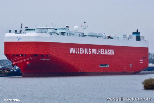
Vessel profile: Toreador is a Vehicles Carrier with dimensions 200m x 33m.
This page combines live AIS, route history, probable destination signals, nearby traffic, and port activity for practical vessel monitoring.
The current position of vessel Toreador is 43.96398 lat / -169.86784 lng. Updated: 2026-05-20 22:31:01 UTCNearest reference points:
- Open sea, approx. 416 nm off the nearest listed port
- Open sea, approx. 415 nm off the nearest listed port
- Open sea, approx. 425 nm off the nearest listed port
Currently sailing under the flag of Malta ![]()
Toreador built in 2008 year
Deadweight:
22098 tDetails:
Live Vessel Toreador Analytics (details, animations, etc.)
Recent AIS points (UTC):
2026-05-20 17:03:20 UTC · 43.96279, -167.92381 · SOG 16.4 kn · COG 268°2026-05-20 17:27:45 UTC · 43.96431, -168.07861 · SOG 16.4 kn · COG 268°
2026-05-20 22:09:00 UTC · 43.96385, -169.75169 · SOG 13.2 kn · COG 266°
2026-05-20 22:31:01 UTC · 43.96398, -169.86784 · SOG 13.6 kn · COG 267°