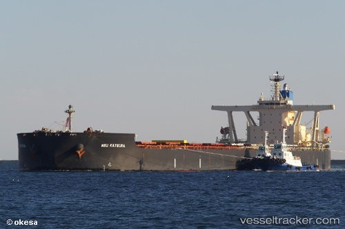
 NSU KATSURA
Current Status
Where is the vessel?
NSU KATSURA is currently in 15 nm NE of Kashima Ko, based on AIS data received about 15h ago.
Latest AIS update:
Current position: 36.12969° N, 140.95428° E (15 nm NE of Kashima Ko)
Average speed (last 7 days): Loading…
Average speed (last 30 days): Loading…
Vessel profile: NSU KATSURA is a Bulk Carrier with dimensions m x m.
This page combines live AIS, route history, probable destination signals, nearby traffic, and port activity for practical vessel monitoring.
The current position of vessel NSU KATSURA is 36.12969 lat / 140.95428 lng. Updated: 2026-05-21 21:27:10 UTCNearest reference points:
- Near KASHIMA
- 12 nm E of CHOSHI
- Near Mito
Currently sailing under the flag of Japan ![]()
Details:
Live Vessel NSU KATSURA Analytics (details, animations, etc.)
Recent AIS points (UTC):
2026-05-21 17:29:11 UTC · 36.24096, 140.97881 · SOG 0.9 kn · COG 88°2026-05-21 19:32:30 UTC · 36.19199, 140.96175 · SOG 1.7 kn · COG -1°
2026-05-21 19:42:31 UTC · 36.18865, 140.96123 · SOG 1.8 kn · COG -1°
2026-05-21 21:27:10 UTC · 36.12969, 140.95428 · SOG 2 kn · COG 96°