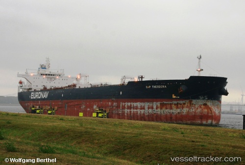
Cap Theodora
Current StatusWhere is the vessel?
Cap Theodora is currently in 42 nm N of Matanzas, based on AIS data received about 14h ago.
Latest AIS update:
Current position: 23.75457° N, 81.61962° W (42 nm N of Matanzas)
Average speed (last 7 days): Loading…
Average speed (last 30 days): Loading…
Vessel profile: Cap Theodora is a Crude Oil Tanker with dimensions 46m x 274m.
This page combines live AIS, route history, probable destination signals, nearby traffic, and port activity for practical vessel monitoring.
The current position of vessel Cap Theodora is 23.75457 lat / -81.61962 lng. Updated: 2026-05-19 20:11:52 UTCNearest reference points:
- Near Summerland Key
- Near Key West
- 28 nm NE of VARADERO
Details:
Live Vessel Cap Theodora Analytics (details, animations, etc.)
Recent AIS points (UTC):
2026-05-19 16:04:28 UTC · 24.00492, -80.89537 · SOG 10.1 kn · COG -1°2026-05-19 17:41:39 UTC · 23.86520, -81.15868 · SOG 10.6 kn · COG -1°
2026-05-19 19:37:35 UTC · 23.76905, -81.51488 · SOG 10.5 kn · COG -1°
2026-05-19 20:11:52 UTC · 23.75457, -81.61962 · SOG 10.6 kn · COG -1°