 WARSHIP D60
Current Status
Where is the vessel?
WARSHIP D60 is currently in Near VISAKHAPATNAM, based on AIS data received about 6d ago.
Latest AIS update:
Current position: 17.68581° N, 83.31626° E (Near VISAKHAPATNAM)
Average speed (last 7 days): Loading…
Average speed (last 30 days): Loading…
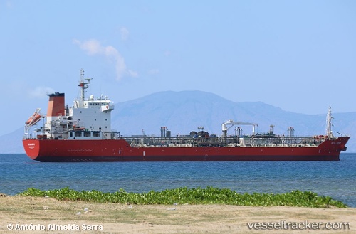
Vessel profile: WARSHIP D60 is a Oil/Chemical Tanker with dimensions m x m.
This page combines live AIS, route history, probable destination signals, nearby traffic, and port activity for practical vessel monitoring.
The current position of vessel WARSHIP D60 is 17.68581 lat / 83.31626 lng. Updated: 2026-05-16 04:42:04 UTCNearest reference points:
- Near Vishakhapatnam
- Near Wipro Sez/Resapuvanipalem
- Near Gopalpur
Currently sailing under the flag of India ![]()
Details:
Live Vessel WARSHIP D60 Analytics (details, animations, etc.)
Recent AIS points (UTC):
2026-05-16 04:42:04 UTC · 17.68581, 83.31626 · SOG 11.3 kn · COG 128°2026-05-16 04:42:04 UTC · 17.68581, 83.31626 · SOG 11.3 kn · COG 128°
2026-05-16 04:42:04 UTC · 17.68581, 83.31626 · SOG 11.3 kn · COG 128°
2026-05-16 04:42:04 UTC · 17.68581, 83.31626 · SOG 11.3 kn · COG 128°