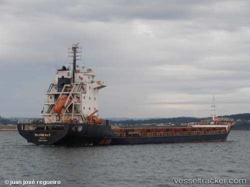
 TEVFIK BEY
Current Status
Where is the vessel?
TEVFIK BEY is currently in Near Saint-Christol, based on AIS data received about 15h ago.
Latest AIS update:
Current position: 43.79896° N, 4.70166° W (Near Saint-Christol)
Average speed (last 7 days): Loading…
Average speed (last 30 days): Loading…
Vessel profile: TEVFIK BEY is a General Cargo with dimensions m x m.
This page combines live AIS, route history, probable destination signals, nearby traffic, and port activity for practical vessel monitoring.
The current position of vessel TEVFIK BEY is 43.79896 lat / -4.70166 lng. Updated: 2026-05-22 14:20:51 UTCNearest reference points:
- Near Mazcuerras
- Near Tremanes
- Near Musel-Arnao
Currently sailing under the flag of Saint Kitts and Nevis ![]()
Details:
Live Vessel TEVFIK BEY Analytics (details, animations, etc.)
Recent AIS points (UTC):
2026-05-22 10:07:21 UTC · 43.80226, -4.66173 · SOG 0.4 kn · COG 156°2026-05-22 12:25:10 UTC · 43.80259, -4.67817 · SOG 0.5 kn · COG 170°
2026-05-22 13:57:30 UTC · 43.79939, -4.69702 · SOG 0.7 kn · COG 154°
2026-05-22 14:20:51 UTC · 43.79896, -4.70166 · SOG 0.8 kn · COG 168°