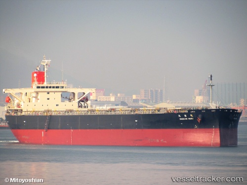
Sakaide Maru
Current StatusWhere is the vessel?
Sakaide Maru is currently in 132 nm NW of Caleta de Sebo, based on AIS data received about 14h ago.
Latest AIS update:
Current position: 31.10488° N, 14.83627° W (132 nm NW of Caleta de Sebo)
Average speed (last 7 days): Loading…
Average speed (last 30 days): Loading…
Vessel profile: Sakaide Maru is a Bulk Carrier with dimensions 43m x 255m.
This page combines live AIS, route history, probable destination signals, nearby traffic, and port activity for practical vessel monitoring.
The current position of vessel Sakaide Maru is 31.10488 lat / -14.83627 lng. Updated: 2026-05-21 17:49:25 UTCNearest reference points:
- 120 nm N of Bañaderos
- 148 nm SE of Porto Santo Island
- 58 nm N of Caleta de Sebo
Details:
Live Vessel Sakaide Maru Analytics (details, animations, etc.)
Recent AIS points (UTC):
2026-05-21 13:17:33 UTC · 30.32503, -15.07103 · SOG 11 kn · COG 16°2026-05-21 16:13:57 UTC · 30.83415, -14.91197 · SOG 10.3 kn · COG 13°
2026-05-21 16:51:06 UTC · 30.93985, -14.88342 · SOG 10.5 kn · COG 14°
2026-05-21 17:49:25 UTC · 31.10488, -14.83627 · SOG 10.4 kn · COG 15°