 DELTA VANGUARD
Current Status
Where is the vessel?
DELTA VANGUARD is currently in 27 nm NE of Galeota Point, based on AIS data received about 14h ago.
Latest AIS update:
Current position: 10.38148° N, 60.62663° W (27 nm NE of Galeota Point)
Average speed (last 7 days): Loading…
Average speed (last 30 days): Loading…
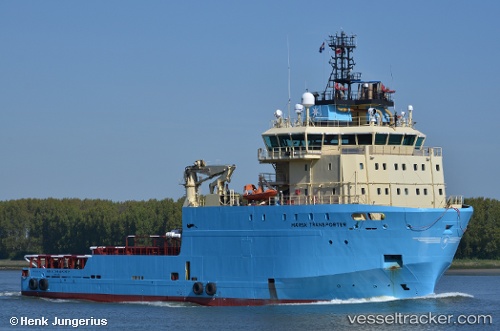
Vessel profile: DELTA VANGUARD is a Anchor Handling Vessel with dimensions m x m.
This page combines live AIS, route history, probable destination signals, nearby traffic, and port activity for practical vessel monitoring.
The current position of vessel DELTA VANGUARD is 10.38148 lat / -60.62663 lng. Updated: 2026-05-20 19:35:55 UTCNearest reference points:
- 16 nm E of Galeota Point
- Near POINT LISAS
- Near Caroni
Currently sailing under the flag of Bahamas ![]()
Details:
Live Vessel DELTA VANGUARD Analytics (details, animations, etc.)
Recent AIS points (UTC):
2026-05-20 15:44:30 UTC · 10.73500, -60.80500 · SOG 8 kn · COG -1°2026-05-20 16:30:35 UTC · 10.63871, -60.75468 · SOG 8.6 kn · COG 152°
2026-05-20 17:49:15 UTC · 10.47789, -60.66186 · SOG 7 kn · COG 149°
2026-05-20 19:35:55 UTC · 10.38148, -60.62663 · SOG 0.9 kn · COG 148°