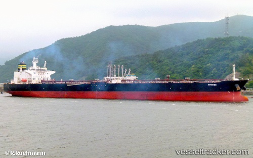
 SMYRTOS
Current Status
Where is the vessel?
SMYRTOS is currently in 19 nm W of Azenhas do Mar, based on AIS data received about 16h ago.
Latest AIS update:
Current position: 38.82927° N, 9.86094° W (19 nm W of Azenhas do Mar)
Average speed (last 7 days): Loading…
Average speed (last 30 days): Loading…
Vessel profile: SMYRTOS is a Crude Oil Tanker with dimensions m x m.
This page combines live AIS, route history, probable destination signals, nearby traffic, and port activity for practical vessel monitoring.
The current position of vessel SMYRTOS is 38.82927 lat / -9.86094 lng. Updated: 2026-05-21 22:24:28 UTCNearest reference points:
- 18 nm W of Colares
- Near CASCAIS
- Near PENICHE
Currently sailing under the flag of Cameroon ![]()
Details:
Live Vessel SMYRTOS Analytics (details, animations, etc.)
Recent AIS points (UTC):
2026-05-21 19:49:59 UTC · 38.32155, -9.74097 · SOG 12.4 kn · COG 349°2026-05-21 19:57:19 UTC · 38.34595, -9.74827 · SOG 12.2 kn · COG 349°
2026-05-21 22:08:38 UTC · 38.77757, -9.85785 · SOG 11.9 kn · COG 359°
2026-05-21 22:24:28 UTC · 38.82927, -9.86094 · SOG 11.6 kn · COG 2°