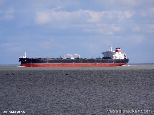
 BULLAR
Current Status
Where is the vessel?
BULLAR is currently in Near Los Ramos, based on AIS data received about 14h ago.
Latest AIS update:
Current position: 38.11507° N, 10.32883° W (Near Los Ramos)
Average speed (last 7 days): Loading…
Average speed (last 30 days): Loading…
Vessel profile: BULLAR is a Crude Oil Tanker with dimensions m x m.
This page combines live AIS, route history, probable destination signals, nearby traffic, and port activity for practical vessel monitoring.
The current position of vessel BULLAR is 38.11507 lat / -10.32883 lng. Updated: 2026-05-20 13:39:25 UTCNearest reference points:
- 18 nm W of Colares
- Near CASCAIS
- Near Sesimbra
Currently sailing under the flag of Sierra Leone ![]()
Details:
Live Vessel BULLAR Analytics (details, animations, etc.)
Recent AIS points (UTC):
2026-05-20 10:33:41 UTC · 37.82736, -10.24071 · SOG 5.3 kn · COG 347°2026-05-20 11:36:11 UTC · 37.91854, -10.26668 · SOG 5.7 kn · COG 347°
2026-05-20 13:22:36 UTC · 38.08554, -10.32114 · SOG 6 kn · COG 350°
2026-05-20 13:39:25 UTC · 38.11507, -10.32883 · SOG 6.5 kn · COG 349°