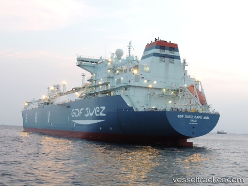
 CAPE ANN
Current Status
Where is the vessel?
CAPE ANN is currently in 45 nm SE of Red Hill, based on AIS data received about 14h ago.
Latest AIS update:
Current position: 32.79424° S, 28.94388° E (45 nm SE of Red Hill)
Average speed (last 7 days): Loading…
Average speed (last 30 days): Loading…
Vessel profile: CAPE ANN is a Lng Tanker with dimensions m x m.
This page combines live AIS, route history, probable destination signals, nearby traffic, and port activity for practical vessel monitoring.
The current position of vessel CAPE ANN is -32.79424 lat / 28.94388 lng. Updated: 2026-05-20 10:17:14 UTCNearest reference points:
- 23 nm E of Port Saint John's
Currently sailing under the flag of Singapore ![]()
Details:
Live Vessel CAPE ANN Analytics (details, animations, etc.)
Recent AIS points (UTC):
2026-05-20 07:35:15 UTC · -32.08369, 29.54800 · SOG 19.1 kn · COG 213°2026-05-20 08:11:01 UTC · -32.23945, 29.41745 · SOG 19 kn · COG 215°
2026-05-20 10:10:07 UTC · -32.76167, 28.97167 · SOG 19 kn · COG -1°
2026-05-20 10:17:14 UTC · -32.79424, 28.94388 · SOG 19.7 kn · COG 215°