 SEAWAYS MYSTERY
Current Status
Where is the vessel?
SEAWAYS MYSTERY is currently in Near Lazaro Cardenas, based on AIS data received about 14h ago.
Latest AIS update:
Current position: 17.89715° N, 102.20100° W (Near Lazaro Cardenas)
Average speed (last 7 days): Loading…
Average speed (last 30 days): Loading…
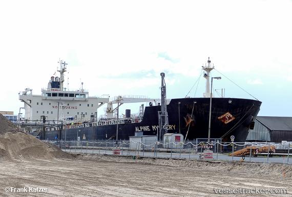
Vessel profile: SEAWAYS MYSTERY is a Oil/Chemical Tanker with dimensions m x m.
This page combines live AIS, route history, probable destination signals, nearby traffic, and port activity for practical vessel monitoring.
The current position of vessel SEAWAYS MYSTERY is 17.89715 lat / -102.20100 lng. Updated: 2026-05-20 08:10:35 UTCNearest reference points:
- Near Lazaro Cardenas
- Near Ixtapa/Zihuatanejo
- 43 nm SW of Antunez
Currently sailing under the flag of Marshall Islands ![]()
Details:
Live Vessel SEAWAYS MYSTERY Analytics (details, animations, etc.)
Recent AIS points (UTC):
2026-05-20 04:44:23 UTC · 17.89712, -102.20082 · SOG 0.3 kn · COG 285°2026-05-20 06:11:24 UTC · 17.89730, -102.20074 · SOG 1 kn · COG 278°
2026-05-20 08:01:41 UTC · 17.89709, -102.20101 · SOG 1.8 kn · COG 295°
2026-05-20 08:10:35 UTC · 17.89715, -102.20100 · SOG 0.5 kn · COG 293°