 VAST CORAL
Current Status
Where is the vessel?
VAST CORAL is currently in 100 nm N of Hamra, based on AIS data received about 14h ago.
Latest AIS update:
Current position: 32.64482° N, 28.72590° E (100 nm N of Hamra)
Average speed (last 7 days): Loading…
Average speed (last 30 days): Loading…
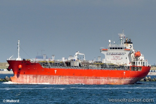
Vessel profile: VAST CORAL is a Oil/Chemical Tanker with dimensions m x m.
This page combines live AIS, route history, probable destination signals, nearby traffic, and port activity for practical vessel monitoring.
The current position of vessel VAST CORAL is 32.64482 lat / 28.72590 lng. Updated: 2026-05-22 10:01:09 UTCNearest reference points:
- 129 nm NW of ABU QIR
- 91 nm SE of Polychnitos Lesvou
- 28 nm N of Hamra
Currently sailing under the flag of Marshall Islands ![]()
Details:
Live Vessel VAST CORAL Analytics (details, animations, etc.)
Recent AIS points (UTC):
2026-05-22 06:06:10 UTC · 32.84943, 27.91383 · SOG 10.9 kn · COG 103°2026-05-22 07:24:30 UTC · 32.78303, 28.18675 · SOG 10.9 kn · COG 103°
2026-05-22 07:46:50 UTC · 32.76315, 28.26355 · SOG 10.8 kn · COG 105°
2026-05-22 10:01:09 UTC · 32.64482, 28.72590 · SOG 10.9 kn · COG 106°