 TURKESTAN
Current Status
Where is the vessel?
TURKESTAN is currently in 58 nm SW of Bekdash, based on AIS data received about 1d ago.
Latest AIS update:
Current position: 40.96733° N, 51.51221° E (58 nm SW of Bekdash)
Average speed (last 7 days): Loading…
Average speed (last 30 days): Loading…
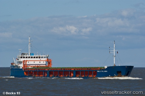
Vessel profile: TURKESTAN is a General Cargo with dimensions 109m x 17m.
This page combines live AIS, route history, probable destination signals, nearby traffic, and port activity for practical vessel monitoring.
The current position of vessel TURKESTAN is 40.96733 lat / 51.51221 lng. Updated: 2026-05-18 09:46:21 UTCNearest reference points:
- 44 nm NW of Bekdash
- 12 nm E of Heydar Aliyev International Apt.
- 27 nm SE of Heydar Aliyev International Apt.
Currently sailing under the flag of Kazakhstan ![]()
TURKESTAN built in 2007 year
Deadweight:
5471 tDetails:
Live Vessel TURKESTAN Analytics (details, animations, etc.)
Recent AIS points (UTC):
2026-05-18 09:46:21 UTC · 40.96733, 51.51221 · SOG 7.8 kn · COG 353°2026-05-18 09:46:21 UTC · 40.96733, 51.51221 · SOG 7.8 kn · COG 353°
2026-05-18 09:46:21 UTC · 40.96733, 51.51221 · SOG 7.8 kn · COG 353°
2026-05-18 09:46:21 UTC · 40.96733, 51.51221 · SOG 7.8 kn · COG 353°