 vesseltracker.com
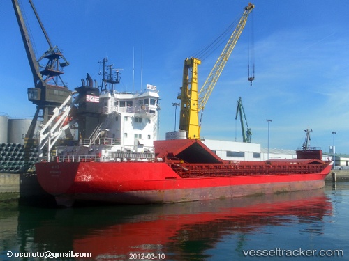
 ALBIZ
ALBIZ
Current Status
Where is the vessel?
ALBIZ is currently in 23 nm SW of Saint David's, based on AIS data received about 14h ago.
Latest AIS update:
Current position: 51.71667° N, 5.82500° W (23 nm SW of Saint David's)
Average speed (last 7 days): Loading…
Average speed (last 30 days): Loading…
Vessel profile: ALBIZ is a General Cargo with dimensions m x m.
This page combines live AIS, route history, probable destination signals, nearby traffic, and port activity for practical vessel monitoring.
The current position of vessel ALBIZ is 51.71667 lat / -5.82500 lng. Updated: 2026-05-18 09:39:21 UTCNearest reference points:
- Near WEXFORD
- Near ARKLOW
- 10 nm NW of Grampound
Currently sailing under the flag of Portugal ![]()
Details:
Live Vessel ALBIZ Analytics (details, animations, etc.)
Recent AIS points (UTC):
2026-05-18 05:48:17 UTC · 51.03167, -5.86683 · SOG 10.1 kn · COG 354°2026-05-18 07:24:17 UTC · 51.30500, -5.87200 · SOG 10.3 kn · COG 358°
2026-05-18 08:18:21 UTC · 51.46667, -5.86167 · SOG 11 kn · COG -1°
2026-05-18 09:39:21 UTC · 51.71667, -5.82500 · SOG 11 kn · COG -1°