 EVALI
EVALI
Current Status
Where is the vessel?
EVALI is currently in 17 nm E of Dalian, based on AIS data received about 14h ago.
Latest AIS update:
Current position: 38.93145° N, 122.01620° E (17 nm E of Dalian)
Average speed (last 7 days): Loading…
Average speed (last 30 days): Loading…
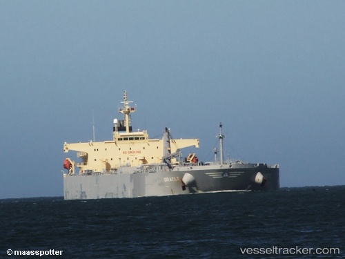
Vessel profile: EVALI is a Crude Oil Tanker with dimensions m x m.
This page combines live AIS, route history, probable destination signals, nearby traffic, and port activity for practical vessel monitoring.
The current position of vessel EVALI is 38.93145 lat / 122.01620 lng. Updated: 2026-06-03 16:25:17 UTCNearest reference points:
- 15 nm E of Dalian
- 20 nm E of Dalian
- 15 nm SE of Dalian
Currently sailing under the flag of Comoros ![]()
Details:
Live Vessel EVALI Analytics (details, animations, etc.)
Recent AIS points (UTC):
2026-06-03 14:19:17 UTC · 38.93172, 122.01615 · SOG 0 kn · COG 207°2026-06-03 14:28:16 UTC · 38.93173, 122.01585 · SOG 0 kn · COG 197°
2026-06-03 15:52:17 UTC · 38.93143, 122.01613 · SOG 0 kn · COG 214°
2026-06-03 16:25:17 UTC · 38.93145, 122.01620 · SOG 0 kn · COG 218°