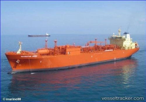
 NAVIGATOR ARIES
Current Status
Where is the vessel?
NAVIGATOR ARIES is currently in 103 nm E of Saint George, based on AIS data received about 15h ago.
Latest AIS update:
Current position: 32.36393° N, 62.65086° W (103 nm E of Saint George)
Average speed (last 7 days): Loading…
Average speed (last 30 days): Loading…
Vessel profile: NAVIGATOR ARIES is a Lpg Tanker with dimensions m x m.
This page combines live AIS, route history, probable destination signals, nearby traffic, and port activity for practical vessel monitoring.
The current position of vessel NAVIGATOR ARIES is 32.36393 lat / -62.65086 lng. Updated: 2026-05-23 07:31:05 UTCCurrently sailing under the flag of Liberia ![]()
Details:
Live Vessel NAVIGATOR ARIES Analytics (details, animations, etc.)
Recent AIS points (UTC):
2026-05-23 04:41:27 UTC · 31.86436, -62.25253 · SOG 12.6 kn · COG 327°2026-05-23 06:09:14 UTC · 32.12193, -62.45888 · SOG 12.9 kn · COG 327°
2026-05-23 07:05:56 UTC · 32.28909, -62.59130 · SOG 12.9 kn · COG 327°
2026-05-23 07:31:05 UTC · 32.36393, -62.65086 · SOG 12.9 kn · COG 326°