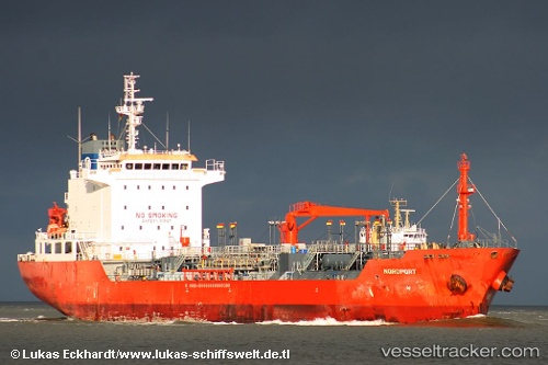
 NORDPORT
Current Status
Where is the vessel?
NORDPORT is currently in 31 nm E of Tan Cang Qui Nhon, based on AIS data received about 4d ago.
Latest AIS update:
Current position: 13.79002° N, 110.35672° E (31 nm E of Tan Cang Qui Nhon)
Average speed (last 7 days): Loading…
Average speed (last 30 days): Loading…
Vessel profile: NORDPORT is a Oil/Chemical Tanker with dimensions m x m.
This page combines live AIS, route history, probable destination signals, nearby traffic, and port activity for practical vessel monitoring.
The current position of vessel NORDPORT is 13.79002 lat / 110.35672 lng. Updated: 2026-05-16 03:14:33 UTCNearest reference points:
- 29 nm NE of Vung Ro
- Near Bong Son
- 17 nm NE of Bong Son
Details:
Live Vessel NORDPORT Analytics (details, animations, etc.)
Recent AIS points (UTC):
2026-05-16 03:14:33 UTC · 13.79002, 110.35672 · SOG 0.5 kn · COG -1°2026-05-16 03:14:33 UTC · 13.79002, 110.35672 · SOG 0.5 kn · COG -1°
2026-05-16 03:14:33 UTC · 13.79002, 110.35672 · SOG 0.5 kn · COG -1°
2026-05-16 03:14:33 UTC · 13.79002, 110.35672 · SOG 0.5 kn · COG -1°