 LUCKY FEB
Current Status
Where is the vessel?
LUCKY FEB is currently in 341 nm S of Svenica, based on AIS data received about 14h ago.
Latest AIS update:
Current position: 40.50333° N, 154.24167° E (341 nm S of Svenica)
Average speed (last 7 days): Loading…
Average speed (last 30 days): Loading…
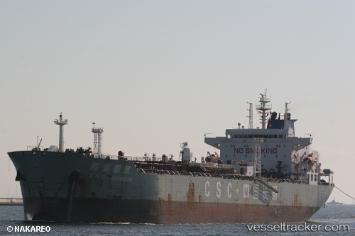
Vessel profile: LUCKY FEB is a Oil Products Tanker with dimensions m x m.
This page combines live AIS, route history, probable destination signals, nearby traffic, and port activity for practical vessel monitoring.
The current position of vessel LUCKY FEB is 40.50333 lat / 154.24167 lng. Updated: 2026-05-21 17:28:19 UTCNearest reference points:
- Open sea, approx. 403 nm off the nearest listed port
- Open sea, approx. 405 nm off the nearest listed port
- Open sea, approx. 406 nm off the nearest listed port
Currently sailing under the flag of Marshall Islands ![]()
Details:
Live Vessel LUCKY FEB Analytics (details, animations, etc.)
Recent AIS points (UTC):
2026-05-21 14:22:14 UTC · 40.56167, 153.47333 · SOG 11 kn · COG -1°2026-05-21 15:37:14 UTC · 40.54333, 153.77834 · SOG 11 kn · COG -1°
2026-05-21 16:33:26 UTC · 40.52917, 154.01068 · SOG 11.4 kn · COG 97°
2026-05-21 17:28:19 UTC · 40.50333, 154.24167 · SOG 11 kn · COG -1°