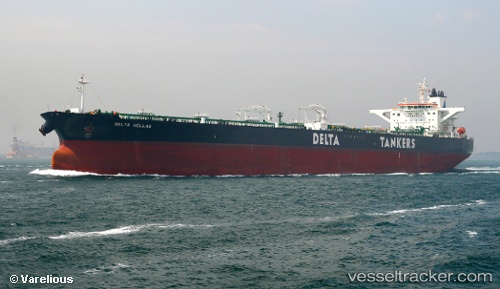
 DELTA HELLAS
Current Status
Where is the vessel?
DELTA HELLAS is currently in 13 nm SE of Cruce Arinaga, based on AIS data received about 15h ago.
Latest AIS update:
Current position: 27.77604° N, 15.15420° W (13 nm SE of Cruce Arinaga)
Average speed (last 7 days): Loading…
Average speed (last 30 days): Loading…
Vessel profile: DELTA HELLAS is a Crude Oil Tanker with dimensions m x m.
This page combines live AIS, route history, probable destination signals, nearby traffic, and port activity for practical vessel monitoring.
The current position of vessel DELTA HELLAS is 27.77604 lat / -15.15420 lng. Updated: 2026-05-20 22:14:02 UTCNearest reference points:
- Near TALIARTE
- Near Las Palmas de Gran Canaria
- Near Las Palmas
Currently sailing under the flag of Liberia ![]()
Details:
Live Vessel DELTA HELLAS Analytics (details, animations, etc.)
Recent AIS points (UTC):
2026-05-20 17:00:05 UTC · 28.84829, -14.46997 · SOG 14.2 kn · COG 217°2026-05-20 17:32:35 UTC · 28.74559, -14.55625 · SOG 14.1 kn · COG 218°
2026-05-20 22:07:51 UTC · 27.80028, -15.14598 · SOG 14.7 kn · COG 200°
2026-05-20 22:14:02 UTC · 27.77604, -15.15420 · SOG 14.8 kn · COG 196°