 Empire State
Current Status
Where is the vessel?
Empire State is currently in Near Anacortes, based on AIS data received about 15h ago.
Latest AIS update:
Current position: 48.51497° N, 122.57014° W (Near Anacortes)
Average speed (last 7 days): Loading…
Average speed (last 30 days): Loading…
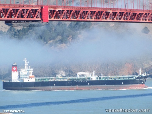
Vessel profile: Empire State is a Chemical Oil Products Tanker with dimensions 183m x 32m.
This page combines live AIS, route history, probable destination signals, nearby traffic, and port activity for practical vessel monitoring.
The current position of vessel Empire State is 48.51497 lat / -122.57014 lng. Updated: 2026-05-20 22:21:49 UTCNearest reference points:
- Near Anacortes
- Near Bellingham
- Near ORCAS
Currently sailing under the flag of USA ![]()
Details:
Live Vessel Empire State Analytics (details, animations, etc.)
Recent AIS points (UTC):
2026-05-20 16:19:36 UTC · 47.62792, -122.45465 · SOG 14.3 kn · COG 356°2026-05-20 18:15:12 UTC · 48.08653, -122.64615 · SOG 17.8 kn · COG 350°
2026-05-20 21:21:49 UTC · 48.51641, -122.57007 · SOG 0.4 kn · COG 121°
2026-05-20 22:21:49 UTC · 48.51497, -122.57014 · SOG 0.1 kn · COG 53°