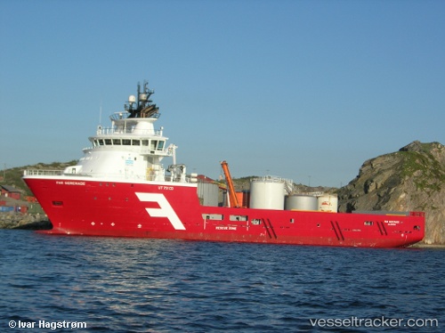
 SERENADE TIDE
Current Status
Where is the vessel?
SERENADE TIDE is currently in Near Aberdeen, based on AIS data received about 15h ago.
Latest AIS update:
Current position: 57.13980° N, 2.08232° W (Near Aberdeen)
Average speed (last 7 days): Loading…
Average speed (last 30 days): Loading…
Vessel profile: SERENADE TIDE is a Offshore Supply Ship with dimensions m x m.
This page combines live AIS, route history, probable destination signals, nearby traffic, and port activity for practical vessel monitoring.
The current position of vessel SERENADE TIDE is 57.13980 lat / -2.08232 lng. Updated: 2026-05-18 21:27:42 UTCNearest reference points:
- Near Aberdeen
- Near PETERHEAD
- Near Peterhead
Currently sailing under the flag of United Kingdom ![]()
Details:
Live Vessel SERENADE TIDE Analytics (details, animations, etc.)
Recent AIS points (UTC):
2026-05-18 17:59:02 UTC · 57.13981, -2.08237 · SOG 0 kn · COG 269°2026-05-18 19:38:03 UTC · 57.13982, -2.08232 · SOG 0 kn · COG 269°
2026-05-18 20:01:12 UTC · 57.13981, -2.08232 · SOG 0 kn · COG 269°
2026-05-18 21:27:42 UTC · 57.13980, -2.08232 · SOG 0 kn · COG 269°