 MALED
MALED
Current Status
Where is the vessel?
MALED is currently in 52 nm W of Thoppumpady, based on AIS data received about 14h ago.
Latest AIS update:
Current position: 9.79667° N, 75.38333° E (52 nm W of Thoppumpady)
Average speed (last 7 days): Loading…
Average speed (last 30 days): Loading…
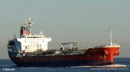
Vessel profile: MALED is a Oil/Chemical Tanker with dimensions m x m.
This page combines live AIS, route history, probable destination signals, nearby traffic, and port activity for practical vessel monitoring.
The current position of vessel MALED is 9.79667 lat / 75.38333 lng. Updated: 2026-05-20 22:10:40 UTCNearest reference points:
- Near Cochin
- Near Edappally
- 45 nm SW of Kalpeni Island
Currently sailing under the flag of Barbados ![]()
Details:
Live Vessel MALED Analytics (details, animations, etc.)
Recent AIS points (UTC):
2026-05-20 16:31:38 UTC · 8.98667, 75.88667 · SOG 11 kn · COG -1°2026-05-20 17:52:39 UTC · 9.18833, 75.73667 · SOG 10 kn · COG -1°
2026-05-20 21:34:41 UTC · 9.69167, 75.36666 · SOG 11 kn · COG -1°
2026-05-20 22:10:40 UTC · 9.79667, 75.38333 · SOG 11 kn · COG -1°