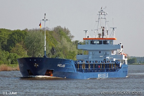
 Melas
Melas
Current Status
Where is the vessel?
Melas is currently in 44 nm SW of Ile D’Ouessant, based on AIS data received about 14h ago.
Latest AIS update:
Current position: 48.07698° N, 6.13781° W (44 nm SW of Ile D’Ouessant)
Average speed (last 7 days): Loading…
Average speed (last 30 days): Loading…
Vessel profile: Melas is a Multi Purpose Carrier with dimensions 90m x 12m.
This page combines live AIS, route history, probable destination signals, nearby traffic, and port activity for practical vessel monitoring.
The current position of vessel Melas is 48.07698 lat / -6.13781 lng. Updated: 2026-05-22 05:50:32 UTCNearest reference points:
- 35 nm SW of Ile D’Ouessant
- 46 nm W of SEIN
- 60 nm SE of San Clodio
Currently sailing under the flag of Antigua Barbuda ![]()
Melas built in 2010 year
Deadweight:
3675 tDetails:
Live Vessel Melas Analytics (details, animations, etc.)
Recent AIS points (UTC):
2026-05-22 02:35:26 UTC · 47.59145, -6.52061 · SOG 8.8 kn · COG 33°2026-05-22 03:58:30 UTC · 47.78965, -6.36732 · SOG 10.1 kn · COG 31°
2026-05-22 04:26:32 UTC · 47.86024, -6.31212 · SOG 10.1 kn · COG 32°
2026-05-22 05:50:32 UTC · 48.07698, -6.13781 · SOG 10.9 kn · COG 26°