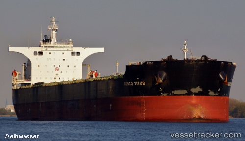
.

MH flag GENCO TITUS

Vessel type: Bulk Carrier | IMO: 9410959 | MMSI: MMSI: 538009964
Call sign: V7A5401 | Dimensions: 45 m x 292 m
Current Status

Where is the vessel?

GENCO TITUS is currently in 67 nm NE of Chan May Port, based on AIS data received about 14h ago.

Latest AIS update:

Current position: 17.26170° N, 108.63750° E (67 nm NE of Chan May Port)

Average speed (last 7 days): Loading…

Average speed (last 30 days): Loading…

Vessel profile: GENCO TITUS is a Bulk Carrier with dimensions 45m x 292m.

This page combines live AIS, route history, probable destination signals, nearby traffic, and port activity for practical vessel monitoring.

The current position of vessel GENCO TITUS is 17.26170 lat / 108.63750 lng. Updated: 2026-05-21 13:21:36 UTC
More recent position available: 58 min ago
Free positions are delayed by 14 hours.

We recommend registering. If you register, paid vessel access will be saved in your profile. Guest access works only through a personal link.

Nearest reference points:
  • 24 nm SW of San-Ya Chiang
  • 48 nm NE of Cua Viet Port
  • 60 nm SW of Ledong

Currently sailing under the flag of Marshall Islands MH flag

GENCO TITUS built in 2007 year

Deadweight:
177729 t

Details:

Live Vessel GENCO TITUS Analytics (details, animations, etc.)


Recent AIS points (UTC):
2026-05-21 09:28:35 UTC · 17.65847, 107.92681 · SOG 11.4 kn · COG 119°
2026-05-21 10:09:55 UTC · 17.58213, 108.03812 · SOG 11 kn · COG 122°
2026-05-21 11:57:56 UTC · 17.39589, 108.36899 · SOG 12 kn · COG 124°
2026-05-21 13:21:36 UTC · 17.26170, 108.63750 · SOG 12 kn · COG 129°

UTC: --
Start: -- Track timeline (UTC) End: --
Encountered: --


Link to the map:


Find another ship

GENCO_TITUS (538009964) last ports (portcalls and passsages)

Dalien | 2025-09-15 05:44:51
Dalien | 2025-09-05 07:23:54
ROBBEN ISLAND | 2025-08-12 14:31:01
Dalien | 2025-07-14 03:23:42
Dalien | 2025-07-04 03:55:18
Ta-Ku | 2025-06-18 00:13:55
Dagu Bar | 2025-06-17 21:52:17
PENGERANG | 2025-06-04 16:57:02
TANAH MERAH | 2025-06-03 18:16:41
BATU AMPAR | 2025-06-03 16:23:05
BUKOM ISLAND | 2025-06-03 14:58:34
BUKOM ISLAND | 2025-02-02 18:13:29
BATU AMPAR | 2025-02-02 17:02:46
TANAH MERAH | 2025-01-31 23:01:10
TANAH MERAH | 2025-01-27 22:02:36
PENGERANG | 2025-01-27 20:15:55
Newcastle | 2024-12-13 01:03:00
Dagu Bar | 2024-11-03 07:25:03
Taku Bar | 2024-11-03 07:02:33
Ta-Ku | 2024-10-25 01:05:20
Taku Bar | 2024-10-24 22:19:38
Sambu | 2024-10-11 12:22:50
Ponta da Madeira | 2024-08-30 06:04:22
Sambu | 2024-07-26 08:36:00
Singapore | 2024-07-06 16:35:34
Willemstad | 2024-05-21 17:17:24
Rizhao | 2024-03-07 19:21:42
Selat Lombok | 2024-02-19 12:50:10
Port Headland | 2024-02-14 11:21:50
Port Hedland | 2024-02-14 11:03:46
Selat Lombok | 2024-01-29 01:04:13
Zhangjiagang | 2024-01-19 05:14:59
Nantong | 2024-01-17 08:46:36
Taicang | 2024-01-17 05:21:06
Wusong | 2024-01-16 07:41:27
Jingjiang | 2024-01-16 02:46:00
Selat Lombok | 2023-11-26 16:48:54
Dampier | 2023-11-22 14:09:54
Bayuquan | 2023-11-03 09:53:54
Dampier | 2023-10-16 16:37:07
Lianyungang | 2023-09-29 09:12:01
Samson Point | 2023-09-12 13:07:02
Sambu | 2023-08-21 01:21:46
Qingdao | 2023-07-30 02:51:31
Qingdao | 2023-07-26 01:59:57
Singapore | 2023-07-15 02:44:35
Sambu | 2023-04-28 19:43:31
Taicang | 2023-04-19 08:19:51
Wusong | 2023-04-16 13:18:41
Samson Point | 2023-03-29 04:48:27
Taicang | 2023-03-04 06:09:06
Lianyungang | 2023-02-28 05:45:53
Richards Bay | 2023-01-22 17:33:22
Maputo | 2023-01-16 20:19:00
Dalien | 2022-05-06 13:12:15
Dalien | 2022-05-02 12:14:26
Dampier | 2022-02-26 12:50:05
Qingdao | 2022-02-02 08:28:34
Zamboanga | 2021-12-05 14:43:51
Manila | 2021-12-02 20:16:34