 MINERVA MARINA
Current Status
Where is the vessel?
MINERVA MARINA is currently in 29 nm NW of ALDERNEY, based on AIS data received about 15h ago.
Latest AIS update:
Current position: 50.04680° N, 2.75022° W (29 nm NW of ALDERNEY)
Average speed (last 7 days): Loading…
Average speed (last 30 days): Loading…
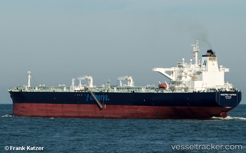
Vessel profile: MINERVA MARINA is a Crude Oil Tanker with dimensions 48m x 273m.
This page combines live AIS, route history, probable destination signals, nearby traffic, and port activity for practical vessel monitoring.
The current position of vessel MINERVA MARINA is 50.0468 lat / -2.75022 lng. Updated: 2026-05-21 22:22:50 UTCNearest reference points:
- 23 nm NW of Saint Sampson
- 16 nm SE of Brixham
- Near Saint Sampson
Currently sailing under the flag of Malta ![]()
MINERVA MARINA built in 2009 year
Deadweight:
157954 tDetails:
Live Vessel MINERVA MARINA Analytics (details, animations, etc.)
Recent AIS points (UTC):
2026-05-21 19:49:27 UTC · 50.17710, -1.87373 · SOG 15.6 kn · COG 256°2026-05-21 19:57:58 UTC · 50.17660, -1.92921 · SOG 15.2 kn · COG 285°
2026-05-21 22:07:31 UTC · 50.05860, -2.66678 · SOG 12.9 kn · COG 257°
2026-05-21 22:22:50 UTC · 50.04680, -2.75022 · SOG 12.9 kn · COG 255°