 Shagra
Current Status
Where is the vessel?
Shagra is currently in 50 nm NE of MALAHAYATI, based on AIS data received about 14h ago.
Latest AIS update:
Current position: 6.07075° N, 96.21817° E (50 nm NE of MALAHAYATI)
Average speed (last 7 days): Loading…
Average speed (last 30 days): Loading…
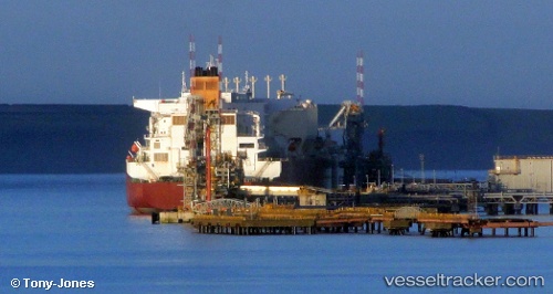
Vessel profile: Shagra is a Lng Tanker with dimensions 345m x 54m.
This page combines live AIS, route history, probable destination signals, nearby traffic, and port activity for practical vessel monitoring.
The current position of vessel Shagra is 6.07075 lat / 96.21817 lng. Updated: 2026-05-23 06:37:10 UTCNearest reference points:
- 53 nm NE of Sebang
- 21 nm N of Sebang
- 28 nm NW of Sebang
Currently sailing under the flag of Marshall Is ![]()
Shagra built in 2009 year
Deadweight:
130102 tDetails:
Live Vessel Shagra Analytics (details, animations, etc.)
Recent AIS points (UTC):
2026-05-23 02:19:12 UTC · 6.37278, 95.31586 · SOG 14.4 kn · COG 83°2026-05-23 03:19:04 UTC · 6.33333, 95.53333 · SOG 13 kn · COG -1°
2026-05-23 04:58:04 UTC · 6.20333, 95.87833 · SOG 13 kn · COG -1°
2026-05-23 06:37:10 UTC · 6.07075, 96.21817 · SOG 13.8 kn · COG 107°