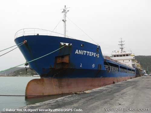
 ANITTEPE S
Current Status
Where is the vessel?
ANITTEPE S is currently in 20 nm NE of Cide, based on AIS data received about 14h ago.
Latest AIS update:
Current position: 42.09536° N, 33.33402° E (20 nm NE of Cide)
Average speed (last 7 days): Loading…
Average speed (last 30 days): Loading…
Vessel profile: ANITTEPE S is a General Cargo with dimensions m x m.
This page combines live AIS, route history, probable destination signals, nearby traffic, and port activity for practical vessel monitoring.
The current position of vessel ANITTEPE S is 42.09536 lat / 33.33402 lng. Updated: 2026-05-18 19:36:48 UTCNearest reference points:
- 27 nm NW of INEBOLU
- 18 nm NW of INEBOLU
- Near Cide
Currently sailing under the flag of Liberia ![]()
Details:
Live Vessel ANITTEPE S Analytics (details, animations, etc.)
Recent AIS points (UTC):
2026-05-18 16:49:38 UTC · 42.24656, 33.67171 · SOG 6.1 kn · COG 236°2026-05-18 18:21:06 UTC · 42.14929, 33.49925 · SOG 6.2 kn · COG 249°
2026-05-18 19:27:58 UTC · 42.10129, 33.35444 · SOG 6.4 kn · COG 251°
2026-05-18 19:36:48 UTC · 42.09536, 33.33402 · SOG 6.7 kn · COG 251°