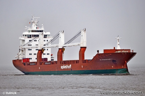
 Donaugracht
Current Status
Where is the vessel?
Donaugracht is currently in 18 nm NE of Nags Head, based on AIS data received about 15h ago.
Latest AIS update:
Current position: 36.06667° N, 75.28463° W (18 nm NE of Nags Head)
Average speed (last 7 days): Loading…
Average speed (last 30 days): Loading…
Vessel profile: Donaugracht is a General Cargo Ship with dimensions 157m x 23m.
This page combines live AIS, route history, probable destination signals, nearby traffic, and port activity for practical vessel monitoring.
The current position of vessel Donaugracht is 36.06667 lat / -75.28463 lng. Updated: 2026-05-21 13:59:45 UTCNearest reference points:
- 18 nm NE of Rodanthe
- 26 nm E of Corolla
- Near Nags Head
Currently sailing under the flag of Netherlands ![]()
Donaugracht built in 2009 year
Deadweight:
17967 tDetails:
Live Vessel Donaugracht Analytics (details, animations, etc.)
Recent AIS points (UTC):
2026-05-21 10:43:16 UTC · 36.80682, -75.77024 · SOG 15.3 kn · COG 147°2026-05-21 11:55:21 UTC · 36.54067, -75.58820 · SOG 15.1 kn · COG -1°
2026-05-21 13:39:40 UTC · 36.14374, -75.33465 · SOG 15.4 kn · COG 151°
2026-05-21 13:59:45 UTC · 36.06667, -75.28463 · SOG 15.6 kn · COG 152°