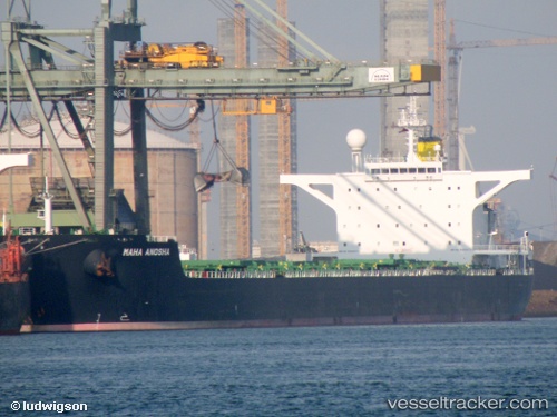
Maha Anosha
Current StatusWhere is the vessel?
Maha Anosha is currently in 105 nm NW of Port Mathurin, based on AIS data received about 14h ago.
Latest AIS update:
Current position: 18.53634° S, 62.02113° E (105 nm NW of Port Mathurin)
Average speed (last 7 days): Loading…
Average speed (last 30 days): Loading…
Vessel profile: Maha Anosha is a Bulk Carrier with dimensions 45m x 288m.
This page combines live AIS, route history, probable destination signals, nearby traffic, and port activity for practical vessel monitoring.
The current position of vessel Maha Anosha is -18.53634 lat / 62.02113 lng. Updated: 2026-05-19 13:24:36 UTCNearest reference points:
- 106 nm NW of Port Mathurin
- 159 nm W of Rodrigues
- 219 nm NW of Port Mathurin
Details:
Live Vessel Maha Anosha Analytics (details, animations, etc.)
Recent AIS points (UTC):
2026-05-19 10:11:51 UTC · -18.21833, 62.62833 · SOG 12 kn · COG -1°2026-05-19 11:54:56 UTC · -18.38581, 62.30666 · SOG 12.6 kn · COG 240°
2026-05-19 13:24:36 UTC · -18.53634, 62.02113 · SOG 12.3 kn · COG 242°
2026-05-19 13:24:36 UTC · -18.53634, 62.02113 · SOG 12.3 kn · COG 242°