 vesseltracker.com
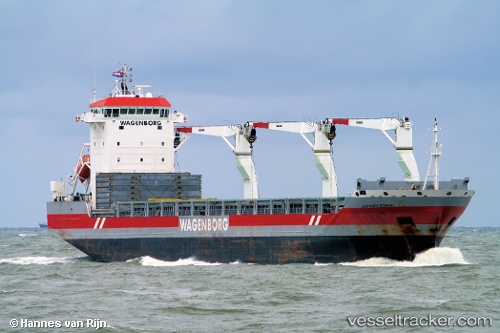
Jose Maria Espana
Current StatusWhere is the vessel?
Jose Maria Espana is currently in 176 nm E of Fort Dauphin, based on AIS data received about 14h ago.
Latest AIS update:
Current position: 24.85800° S, 50.23656° E (176 nm E of Fort Dauphin)
Average speed (last 7 days): Loading…
Average speed (last 30 days): Loading…
Vessel profile: Jose Maria Espana is a Multi Purpose Carrier with dimensions 22m x 655m.
This page combines live AIS, route history, probable destination signals, nearby traffic, and port activity for practical vessel monitoring.
The current position of vessel Jose Maria Espana is -24.85800 lat / 50.23656 lng. Updated: 2026-05-18 01:58:35 UTCNearest reference points:
- 194 nm E of Manakara
- 271 nm E of Fort Dauphin
- 209 nm E of Manakara
Details:
Live Vessel Jose Maria Espana Analytics (details, animations, etc.)
Recent AIS points (UTC):
2026-05-17 22:13:50 UTC · -25.16195, 49.53925 · SOG 11.5 kn · COG 66°2026-05-17 22:21:00 UTC · -25.15167, 49.56167 · SOG 11 kn · COG -1°
2026-05-17 23:51:30 UTC · -25.02840, 49.84898 · SOG 11.3 kn · COG 64°
2026-05-18 01:58:35 UTC · -24.85800, 50.23656 · SOG 10.6 kn · COG 62°